
The geography of the Foggia hinterland holds records that can change the usual image of the region. For those who want to discover one of the highest municipalities in Puglia, the answer lies among the peaks of the southern Daunian Subapennines. Here stands Faeto, a small village of the Monti Dauni set in a landscape of woods, springs and hills. Its territory lies among Monte Cornacchia (1,151 m), the highest peak in Puglia, Monte Perazzoni (1,060 m), Monte San Vito (1,015 m) and Monte Castiglione (959 m), offering an unusual perspective on Capitanata and the landscape of the Apulian Apennines.
The highest point of the village is at 866 metres above sea level, a position that helps give it its mountain character and a cooler climate than the plains. Located south-west of Foggia, Faeto borders Biccari, Roseto Valfortore, Orsara di Puglia and Celle di San Vito and, towards Campania, the territories of Castelfranco in Miscano and Greci.
The charm of the hillside village and its shape
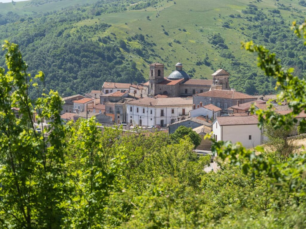
Set on the eastern flank of Monte Perazzoni, the village spreads across the hillside and, like a bird’s nest, blends harmoniously with the profile of the mountain. This particular shape makes it one of the highest and most striking villages to visit in Puglia, especially for those who appreciate the layout of upland historic centres.
The preserved local stone and perched lanes show the importance of rural and medieval architecture in the Monti Dauni, where geographical isolation has kept the original fabric of the village intact. From this natural balcony the eye ranges over the surrounding peaks, which rise above a thousand metres, offering unspoilt scenery where nature still reigns supreme.
A high-altitude territory of peaks and streams
The municipality covers 26.19 square kilometres and is mostly mountainous. The highest point in the region lies right on the border with the territory of Biccari, the starting point for excursions and trekking to Monte Cornacchia, at 1,151 metres the highest peak in Puglia. The mountain profile of the municipality is completed by Monte Perazzoni (1,060 metres) to the west, Monte San Vito (1,015 metres) and Monte Castiglione (959 metres) to the south-east.
This complex relief, together with the geological and soil characteristics of the land, supports a rich network of surface waters feeding the Celone basin through several streams:
- The Canale del Feudo, running for about 4 kilometres north-east of the village.
- The Le Cesi stream, about 1 kilometre long, also to the north-east.
- The Canale Giardina, about 2.5 kilometres long, to the south-east.
- The Aquilonis (or Filamo of the ancients), whose main branch rises on the southern slope of Monte San Vito, skirts the village on the right and enters a channel 4–5 kilometres long before descending to the Tavoliere towards Foggia.
The abundance of natural springs is clear from the historic place names of the territory, such as Bagnaturo north of the village, the Fontanelle area to the south-east and the Acqua La Rama spring at the far south-west, at 620 metres near the border with Greci.
Slow travel and upland identity: what to do in Faeto
The combination of altitude and relative geographical isolation has historically helped preserve not only the natural environment but also the traditions and cultural identity of local communities. The features of the territory and its historically limited contacts with surrounding areas also helped preserve the Franco-Provençal language island of Daunia, one of the most significant testimonies to the cultural heritage of the Monti Dauni.
Today this intangible heritage is an important resource for the development of mountain tourism in Puglia’s inland areas. In summer the altitude generally offers cooler conditions than the Apulian plains, making these territories an appealing destination for those who want to escape the heat of the cities and discover the typical food, local traditions and Apennine landscapes. An itinerary through the villages of the Alta Valle del Celone reveals places with centuries of history, each with its own cultural and scenic character, within the wider context of the villages of the Monti Dauni. An experience that invites you to rediscover the value of time, the authentic dimension of local communities and the deep relationship between people and the nature of the Apennines.
Discover the Alta Valle del Celone
Faeto’s altitude is the starting point for exploring a mountain territory rich in historical and natural connections.
Discover more places in Faeto and the Alta Valle del Celone: keep browsing the site to find the guides to the hiking trails, details of the neighbouring villages and the high-altitude routes that link unspoilt nature with the ancient history of our valley.